Tuesday, 23 February 2016

RIVERS IN GOA

Rivers in Goa

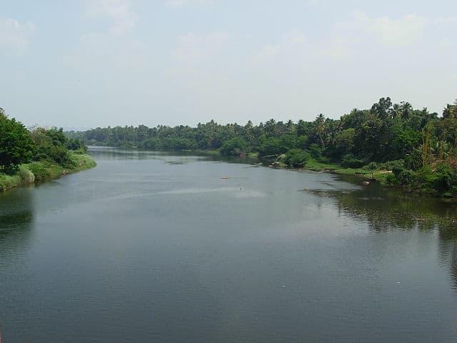
In Goa there are nine large rivers, all of them flow out Western Ghat and flow into the Arabian Sea. 42 smaller tributaries join them, forming a large system of inland waters of Goa called here “backwaters”.
The biggest rivers are Sal, Tiracol, Chapora, Baga, Mandovi, Zuari, Saleri, Talpona, Galgibaga. Among them only basins of the rivers Mandovi and Zuari occupy the area of 2553 square kilometers that makes about 70% of the general geographical zone of Goa. The navigable rivers of Goa with a general length of 253 km are the main blood vessels of the state and the integral part of its life.
To “backwaters” system of Goa belong also some large and great numbers of small lakes. The best known are Mayem, Carmbolim, Cutorim.

For tourists “backwaters” of Goa offer an unforgettable adventure in the form of cruise by the boat. So-called houseboats are widespread in this part of India. These are the real floating houses; there are bedrooms with a bathroom, living room and all necessary rooms, including office for crew. These vessels have very original structure. They are produced from a tree of anjili and only natural materials as a bamboo and palm leaves. The houseboat is constructed without nails and other metal holding elements.
Many local and foreign travel agencies offer cruises on houseboats on water channels of Goa which can last from several hours to one day. For tourists there are various arrangements onboard.
Such excursions are ideal opportunity to communicate with real local residents from near villages or with tribes occupying the deep jungle, and to spend some time in an unusual situation among the tropical nature. In the rivers of Goa lives incalculable quantity of bird species. Some manage to observe the crocodiles. The opportunities for fishing are improbable, and then the personnel may cook your catch at your desire and taste. Also there are romantic dinners and nights in the floating house.


                                                                                                              SU150199

The Douro River Valley

The Douro River Valley

Before we went to the Douro River Valley in Portugal with Viking River Cruises this is what we knew about the area; it’s pretty and there are a lot of wineries.
We were right.
But Viking has this insidious way of actually teaching you all kinds of stuff while you think all you’re doing is having fun. (Could someone please put them in charge of the educational system in the U.S.?)
Now that we have this knowledge we feel a need to share it because it’s actually interesting.

What are the  interesting things about the Douro River Valley?

#1  The Region has UNESCO World Heritage Status
The Alto Douro region is on UNESCO‘s World Heritage list as one of the oldest demarcated wine growing regions in the world.
  • The primary product, port wine, has long been world  famous for its quality.
  •  
  • The cultural landscape is of a traditional European wine-producing region and shows the evolution of this human activity over time.
  •  
  • The components of the landscape represent the full range of activities associated with winemaking – terraces, quintas (wine-producing farm complexes), villages, chapels, and roads.PHYLLOXERA, small, sap-eating, greenish insect of the genus Phylloxera, closely related to the aphid . 
  • Phylloxeras feed on leaves and roots, and many species produce galls on deciduous trees. Their life cycle is complex; one species is known to pass through 21 different stages. Most notorious of the group is the grape phylloxera, Phylloxera vitifoliae, native to E North America. The species has winged and wingless generations, the former causing galls on grape leaves and the latter feeding on the roots, causing nodules and eventually killing the vine. The grape phylloxera came close to destroying the wine industry of France after its accidental introduction in about 1860; grafting of susceptible European vines onto resistant North American root stock saved the European vineyards. Phylloxeras are classified in the phylum Arthropoda , class Insecta, order Homoptera, family Phylloxeridae. 
  •  
  • -SU150031
     

some facts about river Nile

    The Nile Delta
  • The length of the Nile River is approximately 6650 kilometres (4132 miles). It is believed to be the longest river in the world.
  • Located in Africa, the Nile River lies in the following countries: Kenya, Eritrea, Congo, Burundi, Uganda, Tanzania, Rwanda, Egypt, Sudan and Ethiopia.
  • The Nile River has huge significance in regards to Ancient Egypt. Most of Ancient Egypt’s historical sites are located along the banks of the Nile River including cities such as Luxor and Cairo.
  • In 2004, the White Nile Expedition became the first to navigate the entire length of the Nile River. The expedition began in Uganda and finished in Rosetta, taking four months and two weeks to complete.
  • The Nile Delta in Northern Egypt is where the Nile River drains in to the Mediterranean Sea. It is around 160 kilometres (100 miles) in length and spreads out over 240 kilometres (149 miles) of coastline. It is rich in agriculture and has been farmed for thousands of years.
  • Around 40 million people (half of Egypt’s population) live in the Nile Delta region.
  • In 1787, the famous Rosetta stone was found in the Nile Delta in the city of Rosetta. This Ancient Egyptian artifact played a key role in modern understanding of Egyptian hieroglyphics.
  • The Aswan High Dam was built in 1970 to help regulate flooding of the Nile River. Before the Aswan Dam was built, years that featured high levels of water could wipe out crops while years of low level water could produce famines and drought. The dam helps control these water levels.
                                                                                                           SU150083


TOP 7 SCENIC RIVERS OF KERALA

There are 44 rivers in Kerala mostly originating in the Western Ghats as rivulets, later joined by tributaries to grow into large rivers and flowing westwards ending up in the Arabian Sea or in the famous backwaters of Kerala.
Some of these are great rivers worth the name, but quite a lot are big streams or river-turned-into stream because of unwise usage. Still, this river-tributary -distributary system is spread over most of the State bestowing the beloved greenery on Kerala and serves as means of irrigation, waterways and hydro-electric power generation. Being rain-fed many of them unfortunately shrink into rivulets or bare riverbeds during the hot season.

Periyar River

Periyar River
Image by Challiyan Via Wikipedia
With a length of 244 kms, this “Big River” is the longest and serves as the lifeline for Keralites giving precious drinking water to the towns of the region. It originates from the Sivagiri Hills and flows through the Periyar National Park into the Periyar Lake. The Mullayar is a large tributary which joins Periyar before it enters the Reserve. This area is one of unmodified rain forests. Mullaperiyar Dam much in the news is constructed at the confluence of the two.
One of the tributaries is directed to Tamil Nadu as part of an agreement. Downstream the river flows 35 km North West and joins the Idukki reservoir. The Idukki Dam hydro-power station along this river is the largest supplier of electricity to the State of Kerala. In summer the water level at Idukki reservoir is a big concern for the Electricity Board. There are other power projects also on the river, but not of such magnitude.
At Aluva the river bifurcates, one branch flows into the sea and the other into the Kochi backwaters. Sivarathri is celebrated grandly on the Aluva sands.

Bharathapuzha

BharathapuzhaImage by Dhruvaraj S via Flickr
Puzha means river, it is the river of Bharat – India. Also known as Nila, the river originates in the Anaimalai Hills. She rushes through Palakkad Pass and flows westwards blessing Palakkad, Thrissur and Malappuram districts before joining the sea at Ponnani. This river is the lifeline for many towns and villages. Most of it is not navigable. During summer it almost becomes dry and non-existent.
It is no wonder as there are 11 reservoirs along its course. Malampuzha dam is the largest; it is a place that attracts many tourists, to spend a day or stay for a couple of days. All the dams are for irrigation, so one can imagine what a great gift this river is!  A new Regulator cum bridge has come up for the dual purpose of supply of drinking water as well as shortening distance between Thrissur and Kozhikode. The shutter has caused abundant water to collect; the fish species almost extinct have come back, specially the Vaala the king of fresh water fishes.
River Nila has inspired many a poet some famous names among them. Kerala Kala Mandalam for training in Indian performing arts is on the bank of the river, so is the birthplace of Kunjan Nambiar the most renowned satirist poet and the founder of humorous Ottamthullal.
There are some famous temples on its banks. The ceremonies to pay homage to ones ancestors are done at Thirunavaya near Navamukunda temple on the bank of the river. The place has historic importance too, as an arranged fight between the warriors of Zamorin of Kozhikode and  Raja Of Valluvanad used to take place here once in 12 years. The fight would end only when all the members of one group die. It was originally a trade fair, but became a venue for fracas for asserting rights of the respective rulers. Due to avaricious sand mining, the river is slowly dying.
Pampa River
pampa-riverImage by Noblevmy via Wikipedia
Pampa called Dakshina Ganga  is considered holy by Hindus, but even that denomination has not succeeded in keeping it clean. This 3rd longest river originates from the cold Pulachimala Hill 1650m  above sea level in Peermedu plateau and flows through a lot of populated areas such as Ranni, Kozhencherry, Pathanamthitta and so on. It empties into the Great Vembanad Lake. Ten tributaries merge with Pampa during  her course. The river contributes to the agricultural wealth of Kuttanad, the ricebowl  of Kerala.
The shrine of Sabarimala of Lord Shastha (Ayyappan) which draws millions of  pilgrims stands on its hilly bank. A bath in Pampa is a must before “darshan” of the Lord. Mnay consider it equal to a dip in The Ganga.

Manimala River

manimala-riverImage by Chippu Abraham via Flickr
Originating from the Muthavara hills in the Western Ghats at 2500ft, this river flows through Kottayam and Pathanamthitta, joins the Pumba near Thiruvalla. It also ends up in the Vembanad Lake. The river basin is to the north of Pampa river basin.
At the confluence of both rivers was an ancient port Niranam. Manimala River has been an important waterway of central Travancore. It flows through the midland plains giving the precious gift of water to the population.

Chalakudy River

IMG_5776Image by Trilok Rangan via Flickr
 Strictly speaking it maybe a tributary of Periyar but its importance gives it a special individual existence. originating from Anamalai hills, It flows through  Palakkad, Thrissur and Ernakulam districts in the course of 145.5 km. The riparian forests and the high diversity of fish in the river makes this river unique. The riparian vegetation covers an area of 58.5 hectares. More than 300 species of flowering plants, some of them rare, adds to the scenic beauty.
Diversity of fish in this river could be the highest in India. There are nearly 100 varieties of fresh water fish. A lot of them are ornamental used in aquariums. The stunningly beautiful Athirappilly waterfalls is on this river. It is a spot of tourist attraction. There are 2 Hydro-electrical Projects based here. The Parambikulam Dam for irrigation purposes is built on its tributary.

Kabini River

Kuruva islands On Kabini River
Image by Challiyan Via Wikipedia
Kabini is a native of Wayanad, formed by the confluence of  Panamaram and Mananthavady rivers in Wayanad. Farther Kabini flows eastward to join the Kaveri River and empties into the Bay of Bengal. One branch of the Panamaram river starts from Banasura Sagar reservoir and the other from Lakkidi hills.
Two kilometers from the confluence, Kabini forms the Kuruva Island  a fairly large one with diverse flora and fauna. Kuruva Island is a nice spot to spend a day. Within another 20 km the river reaches the Kabini Resrvoir bordering Kerala and Karnataka. Before that Kalindi river in which the rivulet Papanashini near Tirunelly temple has merged, joins Kabani.
The backwaters of the Kabini reservoir recedes in summer forming grassy meadows. Then it becomes a haunt of wild life, specially elephants. The large lake, green landscape and the wild life makes the place very attractive.

 Chandragiri River

Chandragiri River
 She comes to a conclusion, I mean the river ends up in Kasargod district of Kerala and empties into the Arabian Sea. It is a great view to see this river joining the sea as it is a huge mass of water. The 17th century Chandragiri fort stands on her banks. Her origin is in Kodagu district of Karnataka State. On her way the river becomes the major source for domestic and agricultural needs in Sullia Taluk.  The river has also another name Payaswini.
Kerala is crisscrossed by many more rivers and lakes. It is indeed a place to relax and enjoy the green nature at its closest. Hope you will take time to visit one of the above mentioned rivers when you travel to Kerala!


                                                                                                  SU150287

MEASURES TO CONTROL WATER POLLUTION


Water pollution can be controlled in the multiple ways. It is best controlled by the dilution of water. The pollutants must be treated chemically and must be converted into the non toxic substances. The low level of radioactive wastes in the water is removed by the oxidation of ponds. There are certain chemicals which act on the organic insecticide and are used in the pesticide. There are different techniques which are very helpful in the process of thermal pollution and involve the cooling, evaporation, water cooling; cooling can be wet or dry. Their main aim is to keep the water cool in rivers and streams. The shallow ponds must be used to store the domestic and industrial wastes. One must avoid the large ponds. The waste has a presence of sunlight and organic nutrients which may lead to the larger growth of bacteria which act on the waste matter. The reclaimed polluted water can be used in making fertilizers as it is rich in phosphorous, potassium and nitrogen. It can also be used for the irrigation and factories purposes. The proper sewage treatment plans play a crucial role in the reclaimed polluted water. There must be a law which ensures that the industries must treat the waste before the water is discharged into the rivers and seas. The polluted water can be treated by the use of a plant known as water hyacinth which is also referred as kaloli. It deals with the biological and chemical waste. The heavy metals are also removed by it.
                                                                                   SU150083

Rivers of Kashmir

The main rivers that flow through the Kashmir region are Jhelum, Zanskar river, Khurana River, Chenab and Indus. These rivers are of Himalayan origin. The other great rivers that originate from glaciers in the Himalayan region are the Ganges and the Yamuna. The river Indus originates at the Mansarovar Lake in Tibet. Some of the lakes in the Jammu and Kashmir region are Manasbal Lake, Dal Lake and the Wular Lake. Rising from a deep spring at Vernag, the Jhelum meanders northwest from the northern slope of the Pir Panjal Range through the Valley of Kashmir to the Wular Lake. The river Jhelum flows through a long stretch through Jammu and finally drains into the river Indus. This river flows as a muddy stream and is a famous tourist attraction, especially for the nine old bridges over it.

The river Indus originates at the confluence of the Sengge River and the Gar River, that is the Mansarovar Lake in Tibet. This river traces a lengthy and tortuous course and passes through the Kashmir region. This is an excellent area for those interested in white water rafting. The riverbanks are flanked by steep hills that have pine and deodar vegetation. The Indus river flows in-between the Ladakh range and the Zanskar range. The river Indus has several tributaries, principal among them are Gilgit river, Gumal river and Kabul river.
the merging of two Himalayan rivers forms the river Chenab, these are the Chandra river and the Bhaga rivers. Thus the river Chenab is popularly known as the Chandrabhaga. This river is also well known for its historical importance.

The Manasbal Lake lies at a distance of 30 kilometers from Srinagar. Villages on all sides surround the lake. Common vegetation found in the catchment area is apple, mulberry, some Platanus and Salix trees. The Dal Lake is the second largest lake with respect to size in the state of Jammu and Kashmir. This lake is very popular among tourists for its houseboats.

- SU150160

TWO RIVERS


Two Rivers

summer voice, Musketaquit,
Repeats the music of the rain;
But sweeter rivers pulsing flit
Through thee, as thou through the Concord Plain.

Thou in thy narrow banks art pent:
The stream I love unbounded goes
Through flood and sea and firmament;
Through light, through life, it forward flows.

I see the inundation sweet,
I hear the spending of the steam
Through years, through men, through Nature fleet,
Through love and thought, through power and dream.

Musketaquit, a goblin strong,
Of shard and flint makes jewels gay;
They lose their grief who hear his song,
And where he winds is the day of day.

So forth and brighter fares my stream,—
Who drink it shall not thirst again;
No darkness taints its equal gleam,
And ages drop in it like rain.


                                             SU15099